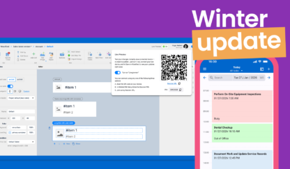
The Fall 2025 release introduces changes that make your Resco solution easier to set up, more powerful in the field, and more efficient to manage. The highlights of the release include a redesigned login experience that shortens onboarding and reduces setup issues, and a powerful new map polygons that let mobile workers draw, measure, and calculate areas directly in the app.
On top of that, Woodford and UI enhancements bring better guidance, more automation, and easier maintenance for developers and project administrators. The rollout will gradually start on October 6.
Let’s look at what’s new in detail.
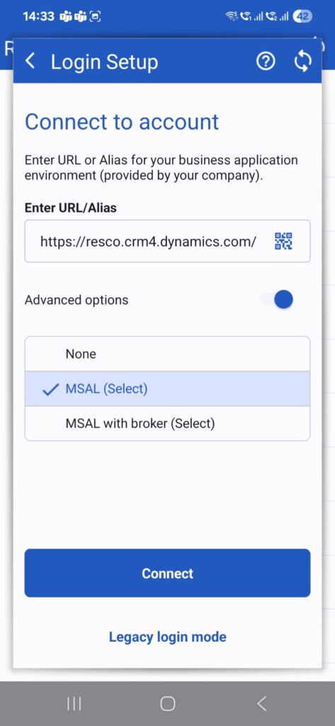
New login: A clearer and faster experience
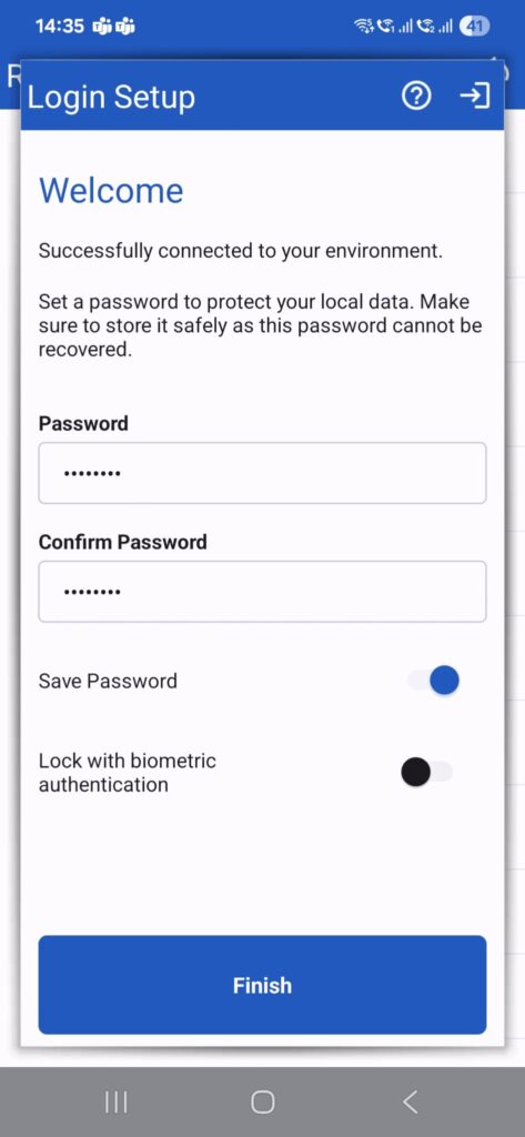
Logging in is often the first interaction with a work app for frontline workers and is important for achieving positive user adoption. The new login process addresses this. It breaks the logging experience into intuitive, multi-step flows that minimize required fields and guide users through the process.
That means fewer mistakes for mobile users and fewer support requests.
Key highlights:
- Automatic tenant recognition: The app now detects whether the user’s organization is based on Dynamics, Salesforce, or Resco Cloud and adjusts the flow accordingly.
- QR code setup: For rapid deployment scenarios, you can use QR codes, enabling capture of both the URL and user mode in a single scan, eliminating manual entry entirely.
- Biometric authentication: Once authenticated, users can unlock the app with Face ID, Touch ID, or Android biometrics for faster and more secure access.
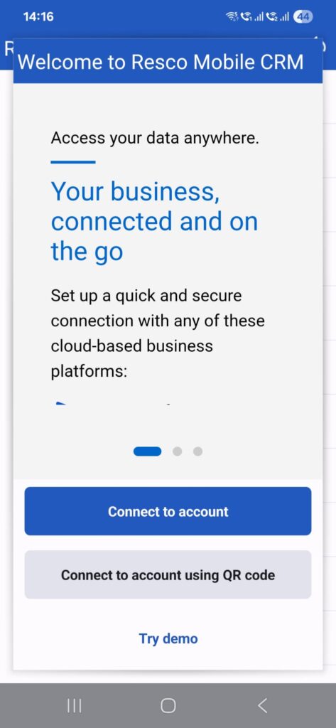
This improvement helps you to save time on training and troubleshooting login errors. Businesses avoid delays during deployment. And frontline workers get into the app without friction, so they can start focusing on their tasks right away.
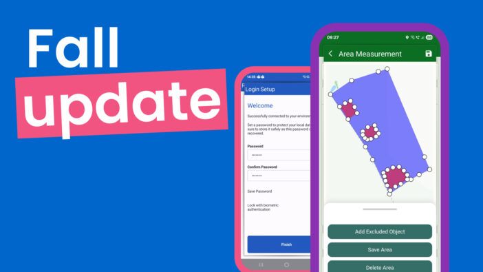
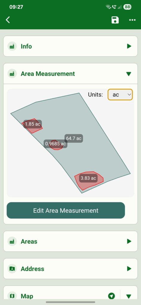
Map polygons: Draw, capture, and measure areas directly in the app (Preview)
Field teams in agriculture, construction, real estate, utilities, and environmental services frequently need to document and measure geographic areas. This traditionally requires dedicated surveying equipment, separate mapping applications, or post-processing spatial data – all of which disrupt field workflows and delay decision-making.
That’s why we are adding a new powerful functionality into Resco. The new map polygon drawing capabilities, available through JavaScript Bridge as npm package, brings comprehensive spatial data capture directly into your Resco app.
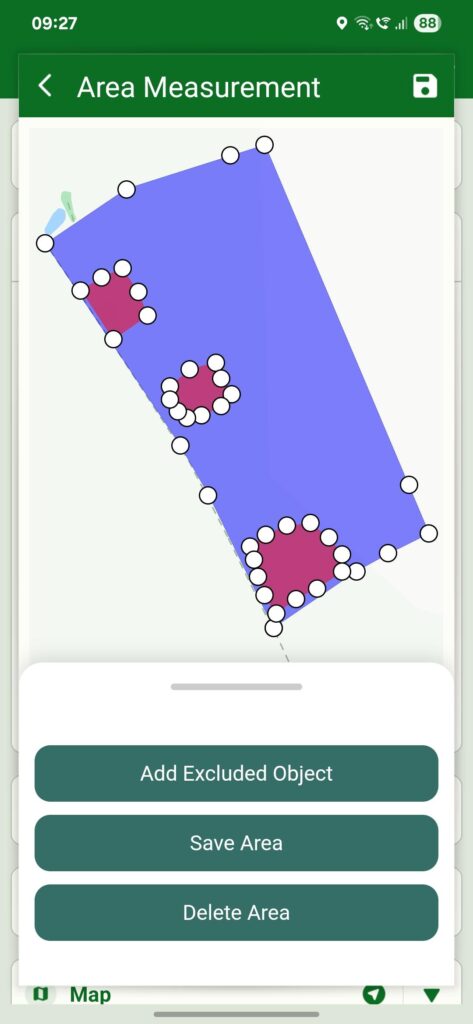
Users can create precise boundary polygons through multiple methods:
- Drawing by hand: Users can sketch directly on the map with a finger or stylus by dropping and moving pins/points.
- GPS tracking: Walking or driving the perimeter automatically creates a polygon shape on the map, based on GPS data.
The system categorizes points as outer boundaries, inner boundaries (for exclusions like ponds or structures), or entry points, then automatically calculates the enclosed area in real-time with support for multiple measurement units (hectares, acres, square feet). All spatial data can be exported in standard formats (GeoJSON, CSV) for integration with back-office systems or compliance documentation.
Why it matters:
- Construction teams can mark building sites.
- Farmers can measure crop fields.
- Inspectors can highlight an inspected zone.
With polygons, they can stay in one app, save time, and ensure data accuracy.
(Note: The polygon tool is available on demand. Please, contact your Resco representative or use a contact form for a request to enable it.)
Enhanced calendar: More visibility, less navigation
Field technicians juggling multiple appointments often need to quickly see details and orient themselves in their daily schedule. The enhanced calendar experience addresses these challenges with four integrated improvements.
- Pinch-to-zoom lets users adjust the time scale intuitively.
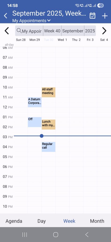
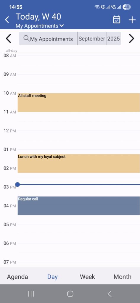
- Current time indicator shows where they are in the day without switching views.
- Visible week numbers now appear in Day, Agenda, and Month views, helping teams coordinate across regions where week-based planning is standard.
- Quick actions on cards enable configurable commands – for example, users can tap an appointment to immediately call the customer, navigate to the location, or update the status without leaving the calendar view.
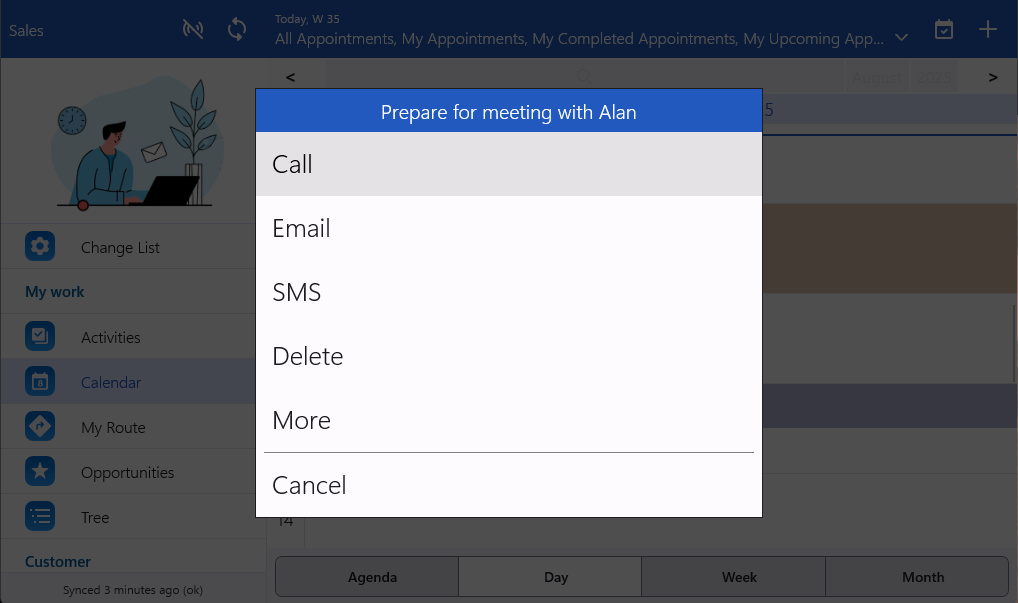
Thanks to the new updates, frontline workers spend less time navigating and more time acting on their schedule. Dispatchers and planners also gain a clearer view of workload and availability.
Better AI Woodford assistant
The Woodford assistant has been updated with an improved system prompt that delivers more accurate and contextual responses to common Woodford-related questions. The enhancement focuses on providing concise explanations, clearer step-by-step instructions, and better context recognition for troubleshooting scenarios.
This reduces the learning curve for new Woodford users and decreases support needs while increasing productivity. You’ll notice more actionable responses with relevant examples that help you solve problems faster.
Centralized styles in Woodford
A new Styles section in the Woodford project menu brings all styling options into one place.
Previously, changing a style required navigating through entity → form/view designer → style editor. Now you can:
- Separate lists for Forms styles and View styles
- Search to quickly locate specific styles
- All style operations (edit, clone, delete) in one place
This streamlines design changes and ensures visual consistency across apps. Admins can update branding or layouts more efficiently and apply changes across projects with less room for error.
Salesforce duplicate sync handling
The sync engine now automatically resolves duplicate record errors in Salesforce. When it finds a duplicate, it switches from Create to Update mode instead of failing.
Special handling for ContentVersion objects ensures that binary files sync correctly, even when duplicates exist.
Why it matters:
- Users don’t have to rerun syncs.
- Support teams receive fewer error tickets.
- Businesses see cleaner data flows with less interruption.
Map lasso tool counter
When using the lasso tool to select items on the map, a counter now displays the number of highlighted records in a footer view below the map. This provides instant feedback for field teams who need to quickly quantify assets, service locations, or other records within a geographic area.
GMT offset function for Woodford rules
A new function is available in Woodford rules, returning the difference between the current user/device timezone and UTC. This enables more sophisticated time-based logic for organizations operating across multiple time zones, with automatic handling of daylight saving time transitions. The function returns a decimal value (e.g., +2.0 for GMT+2, -4.5 for GMT-4:30) that can be used in rule conditions, form rules, and business logic.
See the new features in action
To see these updates in action, join our product webinar on October 23, 2025. Our team will walk you through the new improvements. You’ll see how these features make life easier for mobile workers, simplify app configuration, and speed up deployment for partners and businesses.
For a full overview of the release, out our wiki release page.